
THE Ministry of Tourism and Creative Economy wants Indonesia to have a geospatial map of tourism in which not only presents a variety of tourism potentials, but also the potential for natural disasters that can occur.
According to the Minister of Tourism and Creative Economy Wishnutama Kusubandio explained, the map is needed so that future tourism development plans as stated in the Integrated National Tourism Master Plan can be well recorded. For that reason, I really hope that the Geospatial Information Agency can make this happen.
“In my opinion, this is very strategic so that future tourism development can be designed with details of its potential and all its possibilities, both the potential of unknown tourism and the possibility of natural disasters, so that it can be anticipated. Because, it is related to the comfort and safety aspects of tourists,” Wishnutama said.
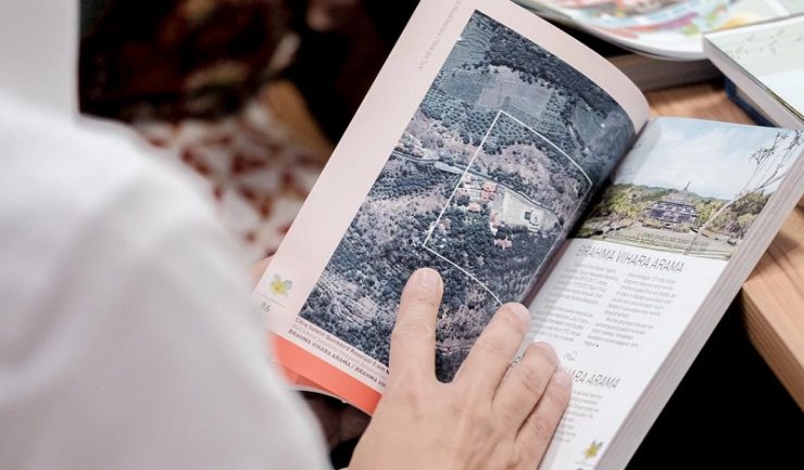
Geospatial or earth space is a spatial aspect that shows the location, location, and position of an object or event that is below, or above the surface of the earth which is expressed in a particular coordinate system.
“There are many tourism potentials that we don’t know about yet. But if we get data information from Geospatial Information Agency, surely we can make strategic steps on how to connect it, explore its potential, and market it. For this reason, tourism development must be comprehensive, not partial,” Wishnutama added.
Meanwhile, Head of Indonesia’s Geospatial Information Agency, Hasanuddin Zainal Abidin said that his party had worked a lot with ministries/institutions and this would be BIG’s first collaboration with the Ministry of Tourism and Creative Economy.
“Previously there were 85 thematic geospatial maps, more or less up to a hundred, maritime could also add 51 themes, 45 disaster themes, social and economic and all kinds would also be added. The better the addition, there will be tourism maps,” Hasanuddin Zainal said.
Hasanuddin explained, the mapping would be presented not only in printed form but also digitally. Because, in addition to attracting the attention of tourists, the application created will make it easier for tourists to access information when visiting Indonesia. [traveltext.id]